The White Rim Rd is a 70mile+ jeep road the circumnavigates the "Island in the Sky" region of Canyonlands NP in Eastern Utah. Quite a few people mountain bike the route in a single day each year, but only a select few even attempt to run the entire road and 26miles of road that links the two end points. Talk began on the special idiots list about making a group run at the road, but as the month of March neared talk never amounted to much and plans were never made. By coincidence Charles Corfield was planning on making an attempt at bettering his previous time on the White Rim Rd the last weekend in March and invited me along to be a pacer/crew member. This situation worked out perfectly for me, I'd get some nice long miles in, but didn't have to commit to running the entire road. So plans were set in motion for the run to take place on Saturday March 30th, 2008.
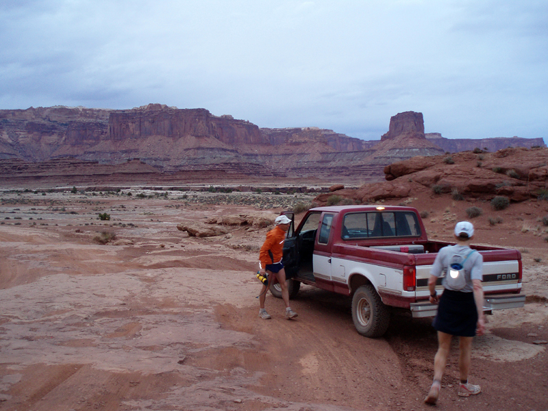
I met Charles in Boulder early Friday morning, we packed up his Subaru and headed out I-70 to Utah, where Canyonlands awaits. We flew down the highway and got out to Utah early, so took a quick drive in to Canyonlands to scout the roads, which were dry as a bone. We settled into the Best Western in downtown Moab and started to organize gear for the coming day. We met Greg(who was going to help crew/pace) at Eddy McStiffs for an early dinner, talked some quick logistics, then headed back to the hotel for some last minute prep. While Charles got ready for bed I went to Pasta Jay's to meet up with Pete, Alex(and family), and Kristen who were running the 24h of Utah the following day. I turned in early as well(8p) in hopes of getting 5h of sleep before our 2am wakeup.
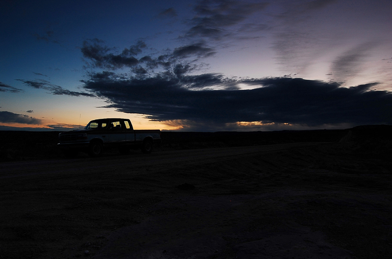
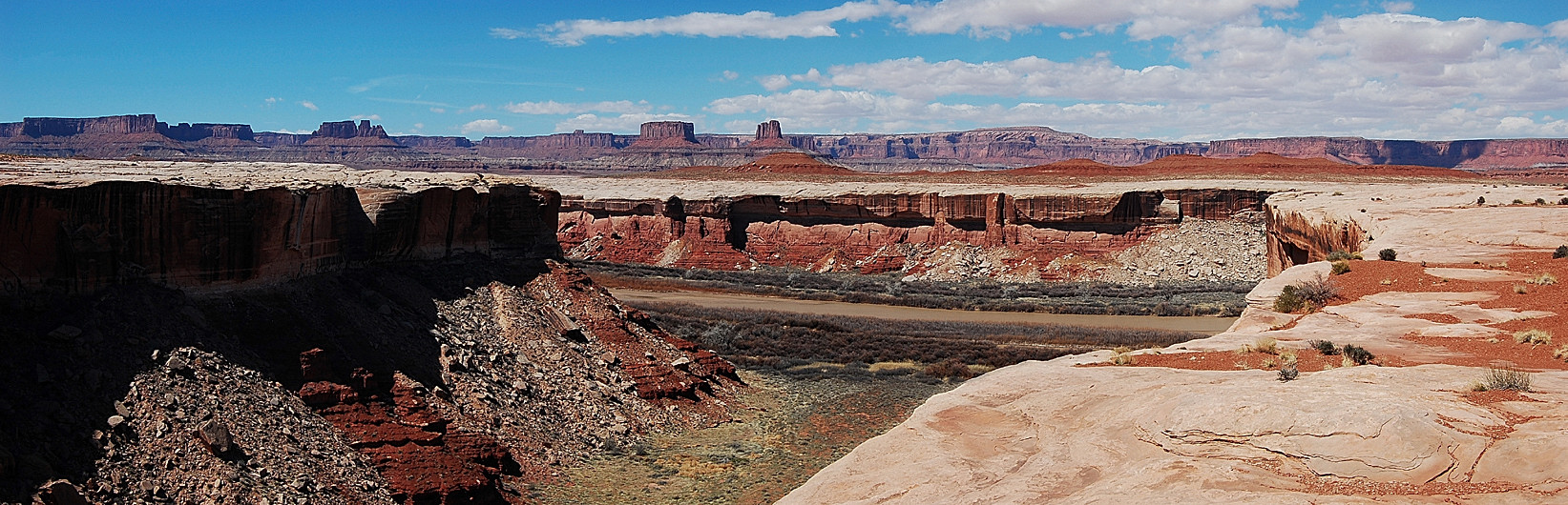
We kept a good clip along the highway, somewhere between 8-9min/mile, chatting in the darkness of the morning. We reached the turn off at Mineral Bottom Rd in just over 2h, I decided to hop in the truck here in order to catch sunrise with my dSLR in hand. Sunrise was decent by Utah standards, with clouds blocking the sunrise the colors were only ok. I snapped a few shots, then regeared up to run some more. Greg and I quickly resupplied Charles, we were getting pretty fast at swapping camelbaks and replacing gels. The sun came into view as we decended down Mineral Bottom, the morning light lit up the canyon walls and the San Rafel swell in the West. Temperatures quickly warmed and we were soon running in T-shirt and shorts. We finally reached the end of Mineral Bottom Rd, a quick, steep decent down to the Green River below. This part of the canyon was very serene, the steep red canyon walls towered above the quiet slow flowing river. The morning sun filtered through gaps in the canyon walls and only the ocassional biker broke the silence.
|
|
|
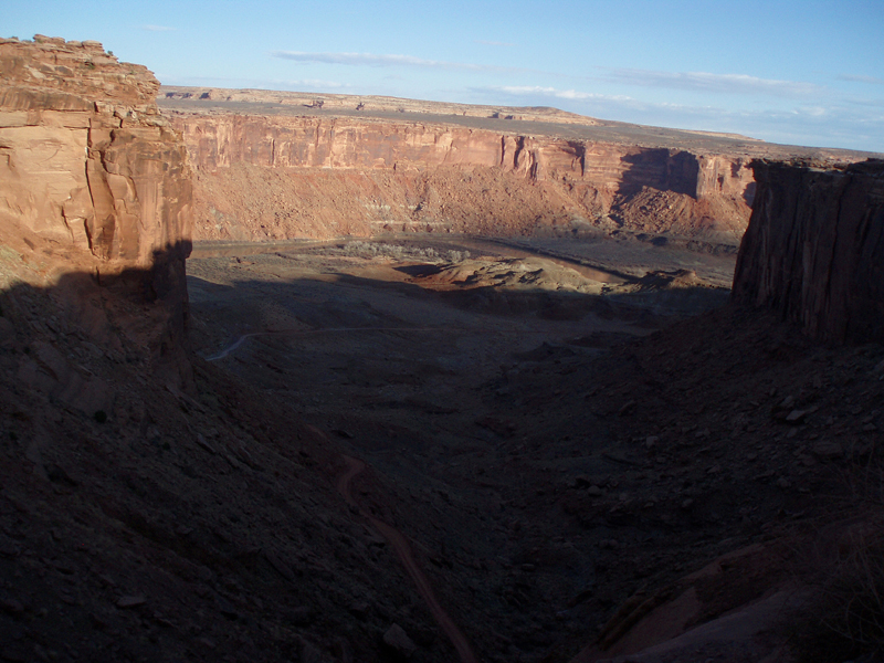
We reached the Labrynth junction, just past mile 33, in 5h20min. Here I would end my morning marathon and take over the driving duties. Greg and I drove the next leg together so he could show me the quirks of his truck and prep himself for the next several hours of running. The climb away from the Labrynth was steep and rocky before decending back down to Potato Bottom, the last time we'd see the river up close. When we met Charles he was still moving pretty well, we refilled him, and I left Greg and Charles to the trail as I moved ahead in the truck. We were now entering the open portion of the canyon where the Colorado and Green River meet up. The canyon is littered with steep walls, giant towers, overhanging cliffs, and the occassional view of the river below. I met Greg and Charles at Unkown Bottom and then at Candlestick campground, the pace was still good despite a few ups and downs in this section.
|
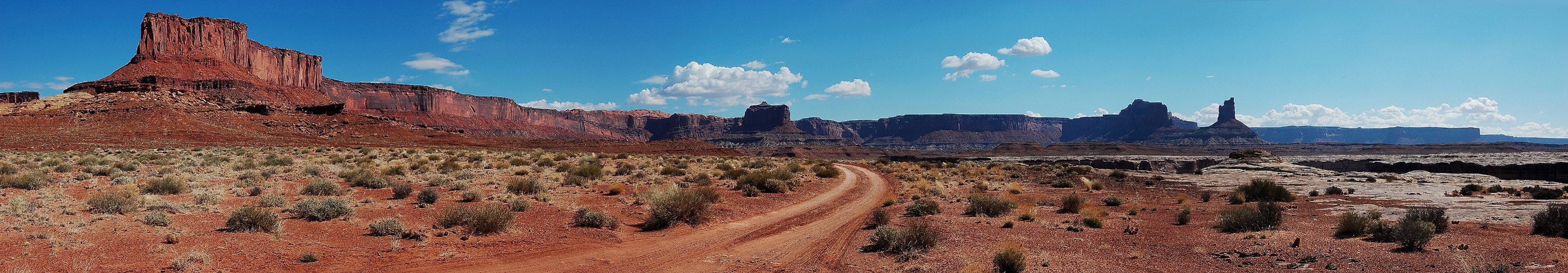
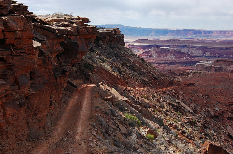
Next stop was Soda Springs Basin on the South side of Candlestick Tower. Candlestick Tower looped over head, with the sheer white walls of Soda Springs Basin below. Greg and Charles showed up shortly, making great time through this mostly flat section, arriving at 9h30min just past mile 54, over half way done! The next section would be a true test of both my driving ability and the state of Charles's legs. The climb up to the Murphy Hogback is approximately 800ft, mostly in the last mile or two. The drive up was pretty rough, I had to lock the truck down in 4low to make it up several steep and rocky sections. From Murphy camp I had a great view of the canyon below, and could barely make out Charles and Greg as they wound their way up the hill. Charles was obviously slowing near the end of the climb, but he never stopped. Greg and I quickly resupplied Charles at Murphy camp before they headed off down the oppositve side of the Hogback.
 |
 |
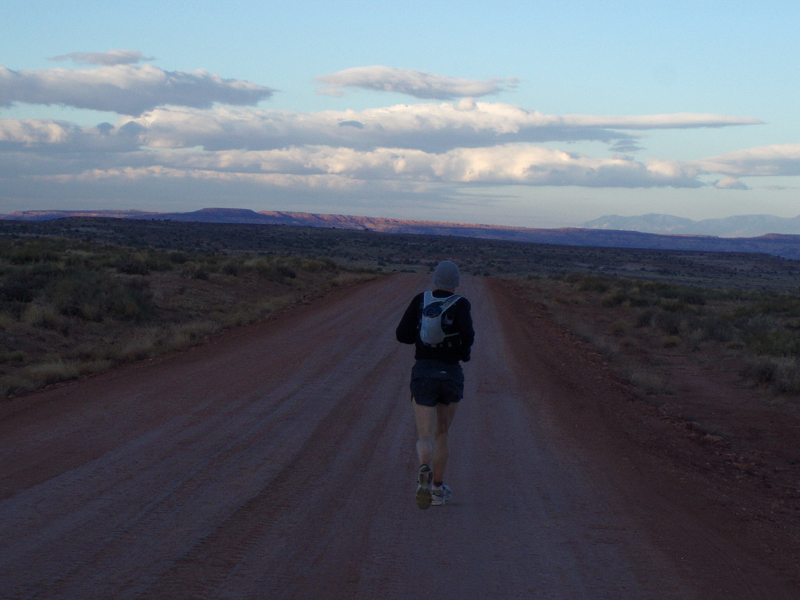
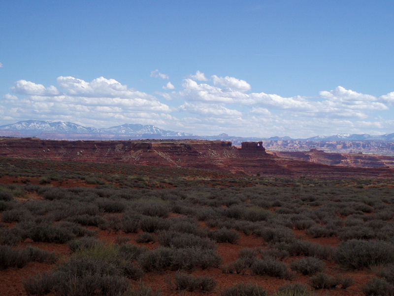
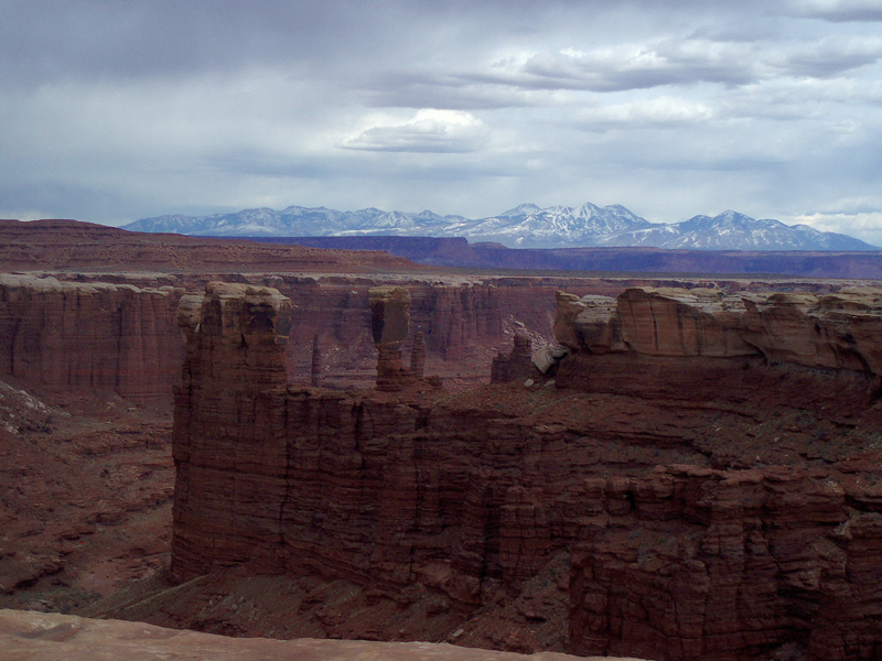
The next stop, Vertigo Void, where I would once again take over pacing. Greg and Charles arrived in just under 12h to mile 64. Greg mentioned Charles was beginning to slow, though was holding a steady pace. Now our jobs as pacers was even more important, keep Charles pushing forward and make sure he stayed on track. Clouds had rolled in and a light breeze had picked up about an hour earlier. This section of the road was absolutely spectacular to run, views of the Abajos and Needles to the south, Monument Basin, and the Lasals to the East. We shuffled along around Junction Butte toward Monument Basin. As we approached Monument basin I spotted a few tourist on the canyon rim far above and waved, though no one probably saw me. We finally met Greg on the rim above Monument Basin, with a quick resupply we were again off headed around Monument Basin. We passed White crack and gently descended toward Gooseberry.
 |
 |
We met Greg on the South side of Gooseberry, by this time Charles was not taking as much gel, but Heed was going down well. So I filled my bottles with HEED, while Charles carried his normal water and gel tube. After leaving Gooseberry Charles's stomach errupted, so we spent a few minutes as he expelled the full bottle of HEED and Ecap he'd just taken. He determined that that the Ecap had set off his stomach, so from then on it was HEED with an Ecap mixed in to dilute it out. This worked well, and after 15min we were back jogging along. We finally met Greg 15h15min into the run at mile 79 near Buck Canyon. Greg would take another turn pacing as the day's light slowly disappeared behind the clouds. I expressed the issue we'd had leaving the Gooseberry, so HEED was the energy source of choice for the rest of the run.
 |
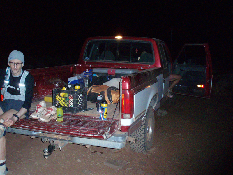 |
I took off slowly in the truck heading down the road toward Airport Tower as the days light disappeared behind the clouds. As I drove along the light went from later afternoon to pitch black in an instance. This section was very rough driving, lots of slickrock where the road seemed to disappear into oblivion. I even had to stop several times just to scout the road ahead, making sure I wasn't about to drive off a cliff into the canyon. I arrived at the Airport campground just before 830p and settled in to wait for the headlamps to arrive. Several large groups were camped out running around, talking, laughing, and completely unaware of the madness that was about to pass them by. I napped off while waiting, but only for a short while. Finally I saw one lights bobbing around on the road not too far off, huh one light. Sure enough it was Greg, followed by Charles, shuffled up to the truck, ready for a sock change and a short rest break. Greg's light had burned out shortly after I left them, so I loaned him mine. I refilled Greg's bottles with HEED and an Ecap, and grabbed Charles's first aid kit so he could do some maintenance on his feet. Off they went into the darkness, two lights this time.
I drove through the darkness, over slickrock, through the sand, up and down little washes. The driving was intense and took all my attention, definitely not as tough as running, but draining none the less. By this time I'd been awake for over 19h and we still had a few miles to go. I pulled over along side Musselman Canyon at mile 89.2 and got changed back in to my running gear, as I was to take the final 7 mile leg back to the base of the Shafer Trail. Greg and Charles arrived 17h55min into the run, just after 10p. Charles was very quiet by this time, but still trotting along. Greg was exhausted as well, and quickly sunk into the seats of the truck, while I readied Charles for the homestretch. Off we shuffled into the darkness, the night was still warm, and I was soon running in a long sleeve shirt and shorts(no hat or gloves). I did my best to encourage Charles and keep him trotting along. My job was to encourage and scout the way, so we never went off track. The road rose and dipped, disapearing in the sand and rock periodically. We finally dropped downhill just beyond the Musselman Arch(which we could not see in the dark). As we wound our way around the short curves I finally spotted Greg and the truck. We stopped and Charles sat down on the back of the truck for one final rest. It was less than 2 miles to the finish, so I urged Charles to push on and finish up strong. We power walked a short bit uphill, then began to slowly jog again until we reached junction with the Gooseneck Trail, our final landmark of the night. I pushed the pace on down the hill, and Charles followed. For the last time the lights of the truck came in to view. We ran all the way up to the gate at the base of the Shafer Trail, touched it, relieved to be done.